Blab AI
Folly Beach Considers AI System to Monitor Beach Health and Visitor Numbers
In a quiet corner of South Carolina, a small town is confronting a problem that is reshaping coastlines worldwide: the relentless advance of erosion. Folly Beach’s city council is set to decide whether to turn to artificial intelligence to keep its sands in check.
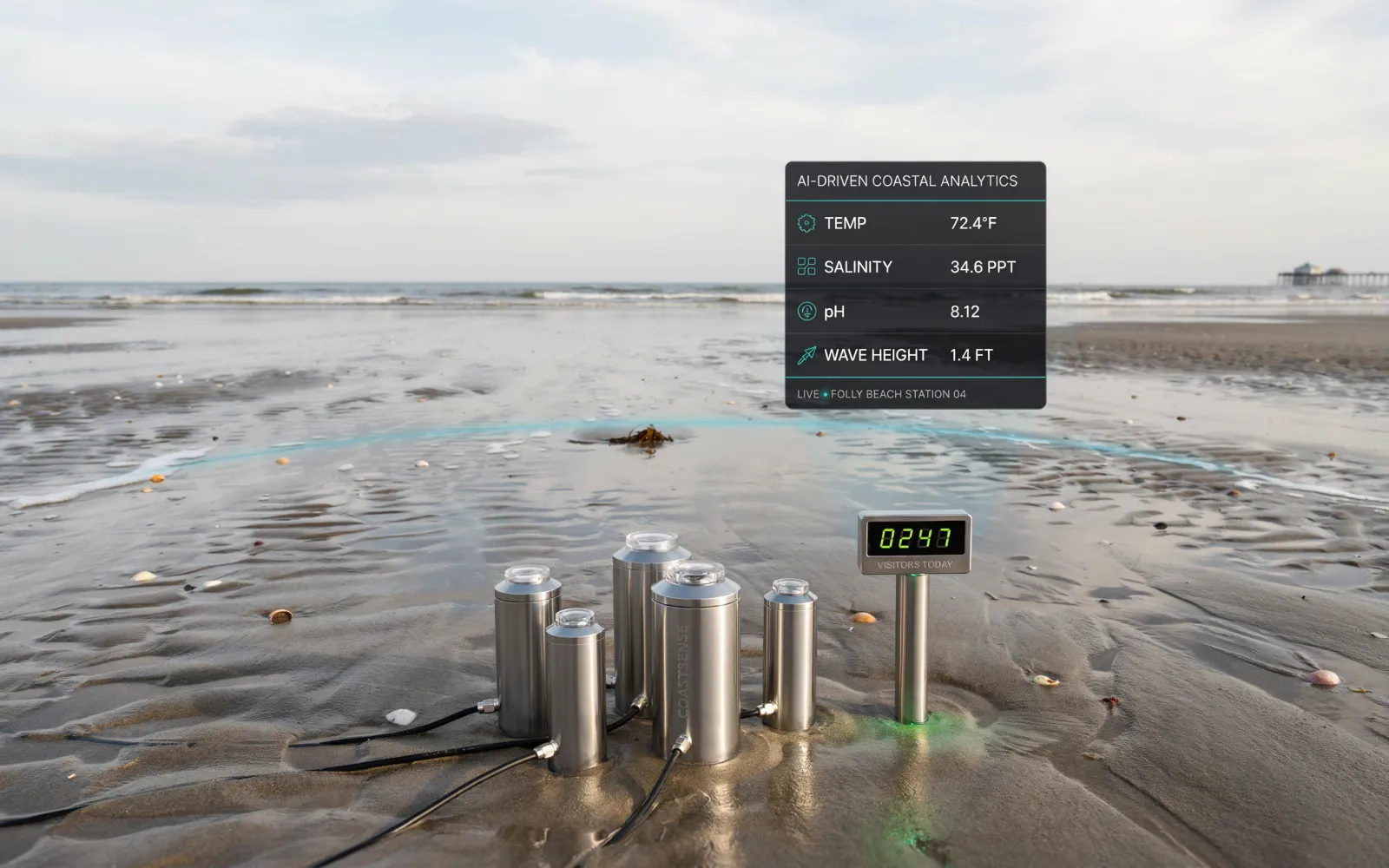
The proposal on the table would earmark $76,500 from the town’s beach preservation fund for a one‑year pilot of a new monitoring system designed by Surfline Coastal Intelligence (SCI). SCI’s plan is simple yet ambitious: deploy a network of high‑resolution cameras along the shoreline to capture real‑time images of the beach’s shape, the movement of waves, and the depth of the water. Advanced computer‑vision algorithms would then sift through the footage, producing continuous reports on how the shore is changing and counting how many people are on the sand and in the surf.
Folly Beach already runs a meticulous beach‑survey program each hurricane season. In June, consultant Dr. Nicole Elko walks the coast, measuring elevations on land and in the water. She feeds satellite‑derived data into a database that records the beach’s width, dune height, and other key metrics. These records serve two purposes: they quantify erosion over time and provide the data required to secure federal repair grants after storms.
SCI’s system would add a new layer of precision to that work. The five cameras proposed for the pilot would sit at strategic points along the shore, capturing a continuous stream of imagery that the AI would process into real‑time erosion maps and visitor counts. By combining environmental data with human traffic patterns, the system could help the town decide where to place lifeguard stations and how to guide tourists away from the most vulnerable parts of the beach.
City officials argue that the dual focus on shoreline health and visitor density would make Folly Beach’s grant proposals more compelling. "By showing exactly where erosion is occurring and how many people are using the beach, we can make a stronger case for state and federal infrastructure funding," said one council member. The data could also be used to direct visitors to less eroded sections, potentially reducing the rate of sand loss in the most exposed areas.
Mayor Chris Bizzell welcomed the idea. "The information we’d get would help us make arguments to state and federal legislators," he said. "It would also give us a concrete measure of the beach’s economic contribution. We get thousands and thousands of visitors every year, and that’s a big part of our town’s identity and livelihood."
If the pilot succeeds, the town plans to expand the system beyond the initial five cameras, covering the entire shoreline and integrating the data into long‑term coastal‑management strategies. The expansion would provide a more comprehensive view of the beach’s health and the flow of its visitors.
The council’s vote is scheduled for Tuesday. The decision will determine whether Folly Beach moves forward with the AI system and could set a precedent for other coastal municipalities seeking data‑driven solutions to erosion and tourism management. Whether the town embraces technology to protect its sands remains to be seen, but the debate underscores a growing trend: small communities are turning to advanced analytics to safeguard their shorelines and economies in an era of climate uncertainty.