Blab AI
Bozeman Deploys AI to Pinpoint High-Risk Intersections and Improve Road Safety
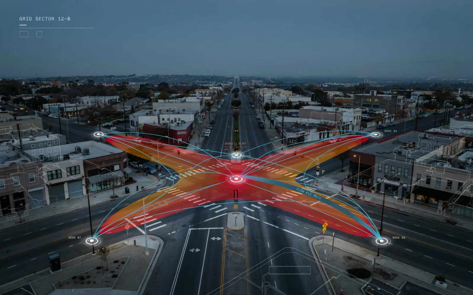
When traffic lights blinked at the corner of Oak and 19th, Bozeman’s streets whispered a warning. In a three‑year deal worth $150,000, the city has turned to AI firm Citian to sift through existing police records and chart the most dangerous spots on its roadways.
The contract, funded through the Safe Streets for All grant, will use data already in the Bozeman Police Department’s possession—no new information will be collected from residents or vehicles. The goal is to produce a clear map of high‑risk intersections, craft a targeted safety action plan, and monitor whether street‑level changes actually reduce incidents.
Traffic violations have surged. Since the start of 2026, the department’s dashboard tallies 1,673 infractions, including 29 at Oak and 19th. January alone saw a 60 percent jump in violations compared with the same month in 2025, a spike the department attributes to the relaunch of its dedicated traffic unit in October 2025.
The numbers are more than statistics. Local driver Jared Ross, who has navigated Bozeman’s roads for over three decades, calls Oak and 19th “the worst spot I’ve seen.” The intersection’s danger was tragically underscored in February, when 39‑year‑old Leslie Brown was struck by a vehicle near Oak Street.
Citian’s platform will ingest crash reports from the police database and apply machine‑learning algorithms to identify risk concentrations. The system will not gather new data from the public; it will rely solely on the incident records already on file.
Nick Ross, Bozeman’s director of transportation and engineering, said the tool “will give us and our public a much clearer understanding of where our problems are most severe, and then give us the ability to target those immediately.” He added that the AI will also track the impact of new signage, traffic‑calming measures, and other street‑level interventions.
Reactions to the initiative have been cautiously supportive. Ross noted that the city “is not designed to handle this many people” and sees potential value in an AI‑driven study.
The city has secured municipal approval for the contract and has begun configuring the system to process the crash database. Officials expect the first set of risk maps within the next few months, after which they will use the findings to prioritize engineering projects. The long‑term aim is to cut traffic violations and pedestrian or cyclist injuries, especially at intersections that have historically seen high incident rates.
While the effectiveness of the AI‑driven approach remains to be seen, the partnership fits a growing trend of municipalities using technology to improve public safety. By analyzing existing crash data instead of collecting new personal data, Bozeman addresses privacy concerns that have shadowed other AI deployments. The city will continue to monitor the system’s outputs and adjust its safety plans accordingly, with the next evaluation cycle scheduled for the end of 2027.